Merged Discussion of femr's video data analysis

The RADAR data supports up to a 20 degree angle at impact.
Supports ?

No. As I said, because the time between each location update is so high (along with numerous sources of uncertainty) there is not enough resolution nor accuracy to capture the last moment aircraft manouvers...
749689034.png


If you check the angle between the last datapoint pair...surprise, surprise...13 degrees clockwise from tower orientation...the same value chosen by NIST...totally ignorant of the last-moment aircraft manouvers.

Good work !

Where a plane is pointed, is not where it is going
As I said, in this case "where it's pointed" is exceedingly close to "where it's going".

Poor femr2 has been making up nonsenses about NIST for years
What's it got in its pocketses, my precious ?

NIST got the speed wrong
They did indeed.

Try and be careful with the inclusion of a few coherent post fragments eh, beachnut. It's not like you at all.
 
Not claiming to know anything about this topic, I note that NCSTAR 1, p. 38, fn. 7 to chapter 3, states, "Plan North was approximately 29 degrees clockwise from True North." NCSTAR 1-2B, p. 161, similarly states that "Structure north is approximately 29° clockwise from True North." ?

Also, can you clarify what is being matched with what?

You're right, it is 29°. I was thinking of the figure used in the MIT paper for some reason.

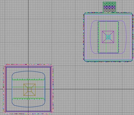
The stills from the Michael Hezarkhani video and the Photo from Carmen Taylor are taken from a similar location at a docked ferry and contain the WTC buildings and two other closer buildings which can be used to locate the viewer location fairly accurately.

I've overlayed Femr2's grid with those elements onto a map at 29 degrees and 31 degrees . Assuming the grid lines are aligned with the WTC building faces a 31° rotation from north gives a better fit effectively adding 2° (not 4° as I said earlier) to any aircraft orientation in Femr2's 3d setup.
 
Last edited:
The stills from the Michael Hezarkhani video and the Photo from Carmen Taylor are taken from a similar location at a docked ferry and contain the WTC buildings and two other closer buildings which can be used to locate the viewer location fairly accurately.
No excrement Sherlock.

I've overlayed Femr2's grid
The one early in the draft, prior to secondary building placement finalisation, prior to camera placement refinement, prior to any actual rotoscoping, prior to inclusion of any aircraft, prior to inclusion of full-scale satellite imagery, prior to... ? :rolleyes:

Good plan ! :eye-poppi

My god man, who'd have thought that three years later, some,er,one hell bent upon attempting to "prove femr2 wrong version the umpteenth" would use a draft image provided for the reader to get an idea about scene layout to try and "prove" ... :rolleyes:

Assuming the grid lines are aligned with the WTC building faces a 31° rotation from north gives a better fit effectively adding 2° (not 4° as I said earlier) to any aircraft orientation in Femr2's 3d setup.
You're determined to try and find some "issue" aren't you :D

Unfortunately you ASSUME too many things.

As I said, do you really think I'd get the bleedin' tower position and orientation wrong ? Jeez. :rolleyes:

Have you noticed where the camera is in that image ? :p

Not to labour the point or anything, but a quick look at the text surrounding that image in the draft document...

Accurate placement of the nose-cone impact point will be undertaken in conjunction with building model rotoscoping.

Definition will be conducted a little later in this document, after camera location of the video footage has been documented, and viewpoint orientation and perspective has been determined. This will allow for more accurate definition of the control point.

Virtual Building Positioning

WTC Complex

Purely to increase rendering performance, buildings in the full WTC complex base model other than WTC1 and WTC2 have been removed.

WTC 1 and 2 relative positioning is fully retained, positioned such that the coordinate of the centre-point of WTC 2 footprint is at (0,0).

The grid shown is in 10ft units.

image051.jpg


Additional Buildings

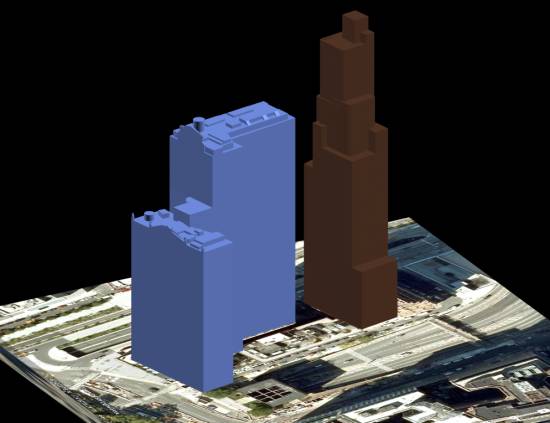
Google Earth/Sketchup models of additional buildings present in the video footage being rotoscoped have been converted to 3DS format and imported into the environment.

As 3D building placement and scaling within Google Earth is not exact, placement of each building has been performed with reference to the underlying satellite photography available within Google Earth, and each model individually scaled according to published building heights. Further refinement of these models is required to fully finalise this method, however every care has been made to ensure the placement is as accurate as possible.

image053.jpg

"Further refinement" included generating the 8192*8192 pixel satellite imagery for the entire scene mentioned earlier, and movement of the secondary buildings to a more correct location.

Several months later (though still years ago), after all manner of refinements...

Ta-da...
938786605.gif
 
Would it be rude to ask when femr2's video analysis will be finished? Is there some criteria to determine this?
 
Would it be rude to ask when femr2's video analysis will be finished? Is there some criteria to determine this?
:) I never got around to a final write-up, so it's not really been touched for almost three years...which makes this "discussion" pretty funny from my perspective.

I'm unlikely to spend time doing so, as the old results are fine. They've been "picked over" by various folk over the years, with no consequence.

NIST messed-up the impact parameters.

Worth mentioning that this recent "discussion" is simply another attempt at "prove femr2 wrong version the umpteenth" provoked by this simple post of 17th March...

How "key" to behaviour of the WTC 2 simulation do you think the trajectory and orientation of the aircraft impact was ?


Folk just can't help themselves can they ;)
 
...Folk just can't help themselves can they ;)
'When you are up to your arse in alligators it is easy to forget that the objective was "drain the swamp" '

The funniest current aspect is the repeated clams by beachnut that there is no gaol. Sure beachnut says the same thing in many posts. Usually as off target as it is here.

femr's two goals which are relevant to this thread have been made clear many times - his global goal of "measuring WTC related matters to a high degree of accuracy" and his goal in this thread of "respond to questions and criticisms".

This thread OP was launched with some expressed good will intentions by tfk and a focus on the single issue of sub-pixel resolution. The validity of sub-pixel accuracy was established for several members in the first few pages. It is very obvious once you think about it - at least to the first decimal order of magnitude below pixel level.

The obvious main topic of the thread would be "Do femr's video data analysis methods produce results that are sufficiently accurate for some purposes?" It seems that nobody wants to debate that one - or at least to produce a clearly stated coherent argument which addresses that topic. For obvious reasons of debate protocol and burden of proof such a claim has to be in the form of a counter argument i.e. a claim that "femr's data is not accurate enough for [whatever purpose]..."

Ah the problems of the scientific method ;) :o
 
:) I never got around to a final write-up, so it's not really been touched for almost three years...which makes this "discussion" pretty funny from my perspective.

I'm unlikely to spend time doing so, as the old results are fine. They've been "picked over" by various folk over the years, with no consequence.

NIST messed-up the impact parameters.

Maybe so. Given all the time you have invested in preparing and defending the work, I see no point in retreating to mere assertion at the point where people are trying to replicate your results.

By no means all, but some, of what you characterize as "prove femr2 wrong version the umpteenth" looks like reasonable questions about replication. It's understandable that you don't have all the details of every analysis you've ever done at your fingertips, but at least a sketch of a soup-to-nuts write-up would be useful, to the extent that your conclusions are pertinent.

The obvious main topic of the thread would be "Do femr's video data analysis methods produce results that are sufficiently accurate for some purposes?" It seems that nobody wants to debate that one - or at least to produce a clearly stated coherent argument which addresses that topic. For obvious reasons of debate protocol and burden of proof such a claim has to be in the form of a counter argument i.e. a claim that "femr's data is not accurate enough for [whatever purpose]..."

Dunno about debating it, but one can descry a reasonably sharp discussion of whether or to what extent femr2's work permits us to infer that (at least one corner of) WTC 7 descended at acceleration g for a while, and another reasonably sharp discussion of whether it permits us to infer that NIST's estimates of UAL 175's impact trajectory were wrong beyond the reported error bounds. It's never gonna happen that everyone on the board agrees that what we are and should be discussing is X.
 
... Try and be careful with the inclusion of a few coherent post fragments eh, beachnut. It's not like you at all.
You used the wrong filter. Cheer up, you were self-trained, you googled it up by mistake. This is what happens when you do pseudoscience studies, list failed 911 truther papers as technical, etc.

... the fictional Official Theory. (femr2)
Will the effort for better data expose the fictional Official Theory?


The RADAR clearly supports up to 20 degrees. Saying otherwise is nonsense, and shows a lack of knowledge of RADAR, and flying procedures.
 
Last edited:
I see no point in retreating to mere assertion at the point where people are trying to replicate your results.
I don't really see what more I could be expected to provide.

Numerous folk have "discussed" the study over the years, with no real attempt to replicate, but simply find some flaw that "makes NIST right".

Even in this recent interest renewal I've linked to the draft...
...which details things like...

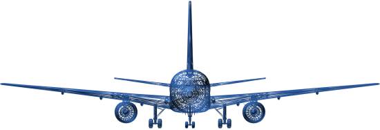
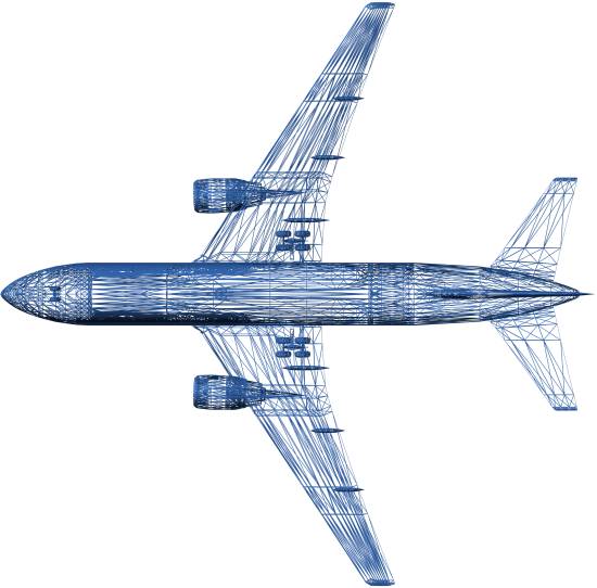
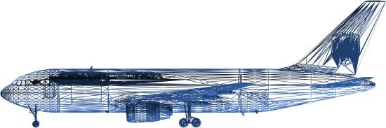
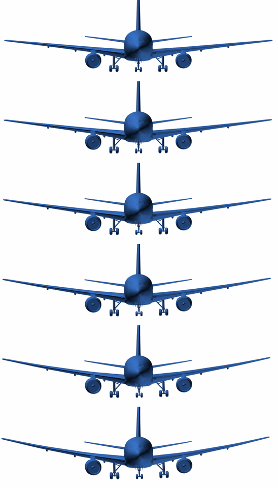
Aircraft model...
image003.jpg

image005.jpg

image007.jpg


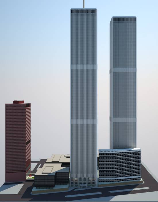
WTC Models...
image013.jpg

..which have been linked to...
You can grab WTC models from my site, here.

Definition of nose-cone and wing-tip penetration points.

Additional Building identification and details.

NIST Orientation Details.

Aircraft Dihedral Wing Angle details...
image070.gif


Parallax Method description for precise camera location determination...
image005.gif

image006.gif


Full satellite imagery for WTC+Secondary Buildings+Camera Location...

Specific Camera Location...
126578805.png


Specification of what Secondary Building features are in-frame...
927663495.png


etc...


Absolutely everything anyone could want in order to replicate the rotoscoped 3D viewpoint results.

By no means all, but some, of what you characterize as "prove femr2 wrong version the umpteenth" looks like reasonable questions about replication.
All you need is:

1) WTC Models
2) Aircraft model
3) Camera Location
4) Satellite imagery
5) Secondary Building details

Reactor Drone specifically has all these details, but is not attempting to use any 3D modeling package to replicate at all.

It's understandable that you don't have all the details of every analysis you've ever done at your fingertips, but at least a sketch of a soup-to-nuts write-up would be useful, to the extent that your conclusions are pertinent.
What more could I possibly provide ?
 
I don't really see what more I could be expected to provide.

First, just to contextualize -- I truly do not intend this as the mother of all goalpost moves. It's apparent that you've done more work than most of your critics.

To me, write-ups are the essence of scientific communication. They're a way of clarifying to others -- and sometimes even to the author -- what methods were used and why. Technical discussions easily can be plagued with sloppy metaphors, but when there is a solid write-up to refer to (and to refine), the empirical work becomes easier to follow. It seems to me that you could take some part of your work and build out the write-up iteratively, rather like an FAQ, reusing things you've already written.

Numerous folk have "discussed" the study over the years, with no real attempt to replicate, but simply find some flaw that "makes NIST right".

Most people here, generally including me, have no competence whatsoever to replicate your work. And this subforum practically specializes in bad debates. So it isn't surprising if the criticisms of your work tend to be "more heat than light." I think most people here are smart enough to understand that finding a flaw in your work wouldn't make NIST right, at least per se. But in the heat of argument, people don't necessarily act on what they know. (People may have other personal motives for wanting to prove you wrong about something.)

At any rate, I've seen some pretty serious discussions of methods that dragged on longer than they might have because of some basic terminological confusion. At times, being able to point to a reference document would have helped.

Even in this recent interest renewal I've linked to the draft...

Yes, and at least once that seems to have led to confusion -- but I think it's better to have a draft than to have nothing. That said, to base the conversation on the draft is sometimes awkward for all concerned, and it would be nice to have a reference that is iteratively updated.

(Many pretty pictures redacted.)

Reactor Drone specifically has all these details, but is not attempting to use any 3D modeling package to replicate at all.

Seems like Reactor drone is still getting stuck on 'sanity checks' that might well precede 3D analysis. Of course, some of the sanity checks may actually be insane, but learning can come from those, too. If Reactor drone eventually trails off without really having done anything, well, learning can come from that as well.

(I don't think I ever reported back to the board on what I learned from the data you pointed me to, perhaps because it seemed too obvious -- but it gave me a first-hand appreciation for why we've spent all this time bickering about smoothing algorithms.
 
First, just to contextualize -- I truly do not intend this as the mother of all goalpost moves.
I agree there is risk of a goalpost move derail.

So I will say that I agree broadly with what you post and I will resist the temptation to enlarge on the areas of slight difference of focus.

...and resisting such temptations is rare for me.... :blush: :o


:D
 
To me, write-ups are the essence of scientific communication. They're a way of clarifying to others -- and sometimes even to the author -- what methods were used and why.
The methods haven't changed since the draft. At all.

It seems to me that you could take some part of your work and build out the write-up iteratively, rather like an FAQ, reusing things you've already written.
All that "changed" from draft is, as is indicated in the draft itself, refinement of element positions.

That process could continue indefinitely, with ever reducing gains.

Yes, and at least once that seems to have led to confusion -- but I think it's better to have a draft than to have nothing. That said, to base the conversation on the draft is sometimes awkward for all concerned, and it would be nice to have a reference that is iteratively updated.
i've nothing against updating such, but it takes time, effort, personal justification.

As I've indicated, anyone actually interested in the impact orientation of UAL175 has all the resources and method descriptions required. They'd need to source an aircraft model but they are available. I can't distribute the model I have as my model license is restricted to renders only.

Seems like Reactor drone is still getting stuck on 'sanity checks' that might well precede 3D analysis. Of course, some of the sanity checks may actually be insane, but learning can come from those, too. If Reactor drone eventually trails off without really having done anything, well, learning can come from that as well.
There is no doubt in the slightest that Reactor Drone has more than enough information to recreate the scene, and understands what he has to do. It's not that complicated really...

Place buildings, camera and aircraft over map. Point camera. Render.

That's about it. You're only taking a picture of the 3D scene after all.

Again, the methods haven't changed since the draft. At all.

I don't think I ever reported back to the board on what I learned from the data you pointed me to, perhaps because it seemed too obvious -- but it gave me a first-hand appreciation for why we've spent all this time bickering about smoothing algorithms.
Can't recall what data I'm afraid. What data ? Dan Rather ? Cam#3 ?
 
Looks like certain features match dimensions but the pools and the surround are smaller than the exterior of the buildings.

http://www.triroc.com/wtc/media/freedomtower/rebuildingadvancing.htm
Seems a strange thing to do.

No matter, you have a fairly accurate centre-point, so as long as you scale correctly in your 3D modeling package you should be fine (assuming you're actually intending on abandoning your inappropriate method and enter the three dimensional world).

Before you ask, no, it doesn't affect my scene. That was done long before the pools were there.
 
...though I'd suggest you go back to older plans of the actual site, so no silly mistakes are made.
 
The methods haven't changed since the draft. At all....


All that "changed" from draft is, as is indicated in the draft itself, refinement of element positions.

That process could continue indefinitely, with ever reducing gains.


i've nothing against updating such, but it takes time, effort, personal justification.

That makes sense. But it is SOP to be able to point to your documentation all in one place. Whether it has any bearing on what Reactor drone is up to, I really don't know.

Can't recall what data I'm afraid. What data ? Dan Rather ? Cam#3 ?

It was Dan Rather, not that I especially cared -- I just wanted to see what the data "looked like."
 
it is SOP to be able to point to your documentation all in one place
For whom ? All bar a few object position tweaks is in the draft. But hey-ho...

Whether it has any bearing on what Reactor drone is up to, I really don't know.
It would appear he is now "losing interest" in trying to refute femr2.

It was Dan Rather, not that I especially cared -- I just wanted to see what the data "looked like."
(Use of my time) Noted.
 
(Use of my time) Noted.

Heh. It was a lot more of my time than of yours. But to elaborate, I didn't just look at the data file and say, "Oh, it's a file," or however you construed my previous comment. I experimented with various ways of extrapolating velocity and acceleration curves. I don't care in the (non-trivial) sense that as far as I an tell, nobody has established the relevance of this analysis -- so, for me at this time, it's more like pure science. The same is true for the trajectory analysis.
 
femr or anyone,
Most of us seem to agree that at least some part of the perimeter wall of Building 7 came down at slighly greater than freefall. Have you or anyone else ever analyzed any other known natural building collapses and found freefall or greater than freefall in some part of the collapse? Especially if the collapsing is of part of the building's actual structure (curtain drop collapses often happen when siding peels off a building and just falls straight down but that might not count). Forgive me if that's already been posted, thought I would ask.
 

ISF - Join now!

Every member here is approved by hand. No bots, no spam, just people who care about evidence and honest debate.

Membership is free!

Create your free account

Back
Top Bottom