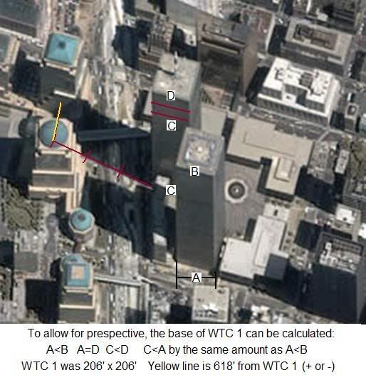
That is NOT a to-scale drawing. It says "based on photographs" not "to scale".
The debris distribution was done from photographs. The map is one that is used for planning purposes in NYC. I ask you again: which part of the map is not to scale? Be specific or withdraw your claim.
Things fall straight down is a statement of fact, not an argument of incredulity.
All things? No force can cause something to not fall straight down? Care to reconsider that, or are you replacing Heiwa while he's on vacation?
The 100-200 feet is a reasonable estimate.
No, it is pulled straight out of your...imagination.
Second time, Chris. Answer the questions.
1) On what analysis of the actual structures and collapses do you base your estimate? What work have you done?
2) How do you account for the facts that the detonations that would be
thousands of times larger than demolitions detonations are not seen or heard, nor are their secondary effects, e.g. light debris being blasted far ahead of the heavy sections that you say are hurled by explosives?
3) And why doesn't a single one of these quite thin "blasted" perimeter columns show
any blast effects? Why did such huge bolted sections, sometimes 12-15 stories containing dozens of bolted connections, remain together?
Answer the questions, Chris.


 ] Second time, Chris. Answer the questions.