• Quick note - the problem with Youtube videos not embedding on the forum appears to have been fixed, thanks to ZiprHead. If you do still see problems let me know.

Michael Shermer vs. "alternative history" Hancock and Crandall

That isn't a city it's a geological formation caused by erosion at different rates in different rock types.

It is known as the Richat Structure
https://en.wikipedia.org/wiki/Richat_Structure

If you zoom in to the highest resolution you will see there are no walls at all, this was never a city.

Initially interpreted as an asteroid impact structure because of its high degree of circularity, the Richat Structure is now regarded by geologists as a highly symmetrical and deeply eroded geologic dome. After extensive field and laboratory studies, no credible evidence has been found for shock metamorphism or any type of deformation indicative of a hypervelocity extraterrestrial impact.

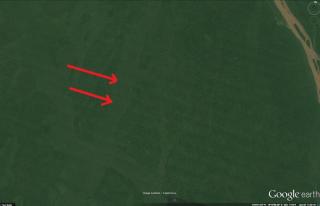
I found walls, and ruins...

I read they found salt, but I need more information. I think multiple events have shaped that site. First, there are others, and some look like they too have been utilized for human activity.

Look at the sand that was carried through the pillars...! The wash of sand looks over 300 miles wide!

when was Africa last flooded?
 
?

What are we supposed to be seeing in that picture?

More grid gardens? What size are they according to your measurements? If it's the horizontal lines in the mediterranean see floor, then they're spaced on the order of 8-10 miles apart.

Yet you've said that ALL of the grid gardens are the same size. Are now claiming that all of the grid field patterns you've posted are actually 8-10 miles in diameter? :confused:

You abandoned that claim when I asked you for specifics in the "Grid Garden" thread and said you "weren't sure" and I see you're back to claiming in this thread that all the grid gardens are the same size? Flip flopping that would make any politician proud.

Please explain what you mean when you say the grid gardens are all the same size? The same area? The same width and length? How much leeway is allowed before they are no longer acceptable as being the same size?

You're not going to give any answer to this, despite making the claim repeatedly, because it's obvious at even a casual glance that your "grid gardens" conform to no consistent size or shape and range and if anyone were to actually test your claim it would show it to be the meaningless wildly inaccurate nonsense it obviously is.

So please explain, with specifics, what you mean when you claim that all the grid garden are "the same size".

So, there are many different sizes of grids, the older, the bigger, 'seemingly'...I haven't actually dated everything or even anything myself.

What I'm thinking is including that which measures 888x222 feet, as long as it appear in a grid...HOWEVER. Bigger = Older and submerged would have to equal both old and difficult to find. By my measurements they look like they are 6 miles apart, and maybe 130 miles long (?), but they may not be 'plow rows' but rather irrigation channels for really large grid gardens.

ETA: I think grid gardens should be any garden with dimensions of 4/1 in width and length, that appears in the form of a grid, bigger than "12 men with two oxen each"...one man can farm about 2-3 acres alone with a team of mules. So, anything more than say 36 acres, within a single grid...that's more than a common King or Lord could easily muster.

That said, I'm open to suggestions...?
 
Last edited:
You admit they are neither the same size nor the same shape, your claim was a lie. And you admit that you haven't dated anything.
In the very same sentence, you make a claim about the dating of these fields.
Another lie.
 
BWAAAA HAAAA HAAAA!

It's almost like you have completely ignored all of my pictures!

You mean this picture you've never posted before? The one that doesn't appear to be of the same geological formation as the previous one?
This picture, which, while called 'walls', does not show any walls?
You know, those walls you've never pointed out or provided evidence for?
Yes, all lies.
 
So, there are many different sizes of grids, the older, the bigger, 'seemingly'
I'm confused. Are they all the same size or not? Yes or no?

If the answer is YES, then please explain what size it is that they all are. Is it area, length and width or what? To what degree of tolerance are they all the same size?

If the answer is NO, then why have you repeatedly said (including recently in this thread) that they're all the same size?

...I haven't actually dated everything or even anything myself.
No **** Sherlock.

What I'm thinking is including that which measures 888x222 feet, as long as it appear in a grid...HOWEVER.
You're including anything in your grid gardens idea as long as it looks vaguely like a grid on Google Earth, no matter whether it's underwater, in the jungle, in a desert, etc. By saying that you're including 888x222 feet fields in your 'grid garden' concept you have done nothing to clarify anything.

What are you excluding from your grid garden idea? Nothing. As long as you find something vaguely grid shaped on Google Earth, you simply throw it onto the pile of nonsense you've been building. Regardless of shape, size or location. Yet you keep repeating that they're all the same size and shape.

You're clearly afraid to make a commitment to the 'same size and shape' idea because your grid gardens are in no way whatsoever the same size or shape, but you want to hang onto the idea because it allows you to claim that you've found something special, so you flip-flop between whether or not you think they're the same size and shape and remain completely non-committal when asked to define what it is you mean when you do claim they're the same and shape.

ETA: I think grid gardens should be any garden with dimensions of 4/1 in width and length, that appears in the form of a grid, bigger than "12 men with two oxen each"...one man can farm about 2-3 acres alone with a team of mules. So, anything more than say 36 acres, within a single grid...that's more than a common King or Lord could easily muster.
I think you'll forget about this idea as you continue to find 'grid gardens' that are much bigger and much smaller than 36 acres. This is just a meaningless figure thrown out in the hopes that people will think you've answered the question about what it means for the grid gardens to be the same size and shape.

Prediction: You will continue to remain vague and non-committal about what "the same size and shape" means in reference to your grid gardens and will post images of anything from modern field patterns to vague underwater features that vary wildly in shape, size, structure, look, etc. while still trying to sneak in the idea that they're actually all the same, so you can pretend you've proven something.
 
You admit they are neither the same size nor the same shape, your claim was a lie. And you admit that you haven't dated anything.
In the very same sentence, you make a claim about the dating of these fields.
Another lie.

Two questions, "Do you know what a lie is?" & "Have you ever hear of the story of the boy who cried wolf?"

---

Yes, there are grids of different sizes, but there are also remotely located, sparsely populated, abandoned grids that are no longer gardens...I'm thinking of including anything that is 4/1 length and width, that also appears in the form of a grid...
 

Attachments

  • GG.jpg
    GG.jpg
    30.4 KB · Views: 9
That's not what these are...

None of the images I've posted are 'digital artifacts'. I have been very careful to exclude anything remotely similar.
The images you posted of ocean floor pathways (or whatever you think they are) which might contain 'guild posts' (whatever that means) are in fact digital artefacts. This has been repeatedly explained to you and links have been provided to articles explaining the existence of these long straight underwater lines in Google Earth.

All those underwater criss crossing straight lines you posted images of are clearly and obviously mapping artefacts from Google Earth. You think they're something else, but you won't explain what. That's probably a good idea, because everyone realises that the idea of navigation pathways with 'guild posts' on the Pacific ocean floor, thousands of feet below the surface, running for thousands of miles long and miles wide, is a laughably absurd idea, so you won't talk about it any more. It's an utterly daft idea to think people created these on the ocean floor so that they could find their way from Easter Island to some tree plantation in Chile. It's hard to even know where to start explaining what's wrong with the idea.

You said that some are artefacts and some aren't, but you've provided no rationale or evidence to distinguish between them, and given that the pictures you posted earlier in the thread were clearly all of the similar mapping artefacts, it's hard to know how you can say things like this with a straight face.

I'd love to hear you try and defend this idea of ocean floor features thousands of feet below the surface, thousands of miles long and miles wide used by ancient people for navigating, it's truly an indefensible idea, so you won't. But you'll still hang on to the idea that you can use these special lines to find... whatever it is you think you're finding.
 
The images you posted of ocean floor pathways (or whatever you think they are) which might contain 'guild posts' (whatever that means) are in fact digital artefacts. ...

Objection: Speculation, outside of the witness's expertise.

AND...

"Not all lines are the same"...some are indeed anomalies, some are mountain ridges, some are detailed scans of the ocean floor. But there are others that are dis-similar to these things.
 
"Not all lines are the same"...some are indeed anomalies, some are mountain ridges, some are detailed scans of the ocean floor. But there are others that are dis-similar to these things.
Post a screenshot of one of the "dissimilar" ones. Explain your rationale for thinking why it is different to the artefacts caused by runs of detailed scans in what is otherwise low res ocean floor renderings.

Explain while you're at it what you think these lines are. They're miles wide. They're at the bottom of the ocean. They're thousands of miles long.

How could ancient peoples possibly have constructed such whatever they are? That's an engineering project of unimaginable scale, way beyond anything being done today.

And for what purpose? You seem to think it's some sort of navigational aid with your oblique reference to 'guild posts' but I can't even imagine how something on the ocean floor, thousands of miles long, miles wide, thousands of feet below the surface is in any way whatsoever useful as a navigational aid. It's an insanely absurd idea.

At the very least, just post an example of one of the 'real' underwater lines with your rationale for why you think it is whatever you think it is. Something better than simply telling us that you followed the line and eventually it hit land and you found some trees or fields or whatever. As would happen if you followed any imaginary lines on Google Earth, you're eventually going to find fields or trees or whatever. And given how loose your idea is for what qualifies as an interesting find on Google Earth you could just stick a pin randomly anywhere and you'd claim whatever it was was evidence of a pre-Columbian advanced agricultural Atlantean beer drinking grid gardening culture. Or whatever you think you're claiming.
 
I think we are all capable of measuring blocks and reporting on their sizes.
1. You're clearly not. You can't decide what size the blocks are or whether or not they're the same size. You're all over the place when it comes to the sizes of blocks. Whatever you might be capable of, measuring blocks in Google Earth is clearly beyond your skills.

2. You have done a lot more than 'measure blocks' in this thread. You have made claims about underwater lines and how to tell the difference between real ones and Google Earth artefacts. You have made claims about tree canopy sizes and their relation to plantations being pre-Columbian. You have made claims about the existence of underwater quarries off Easter Island. Etc. etc. This thread is full of all sorts of wild and weird claims from you. You're fooling no-one by trying to just narrow it down to you making claims about the size of grids on Google Earth (and you can't even make up your mind about what you're talking about when it comes to the size of these imaginary grid gardens).

Do you have expertise in any of these things? Obviously not. Yet you keep making claims about them.

Hence my accusation of hypocrisy. It's intensely hypocritical of you to keep throwing out wild and weird speculations on a wide variety of subjects, one after the other, and then try to silence others by accusing them of speaking of things outside their area of expertise.
 
That's not what these are...

None of the images I've posted are 'digital artifacts'. I have been very careful to exclude anything remotely similar.
Are the red arrows I added to the image you posted previously pointing to your "plow lines"? The grayish lines running almost horizontally?
thum_134095a202c723b231.jpg
 

Back
Top Bottom