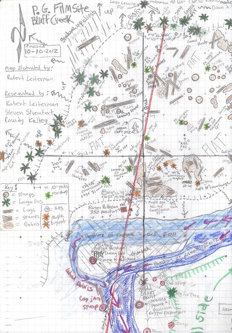
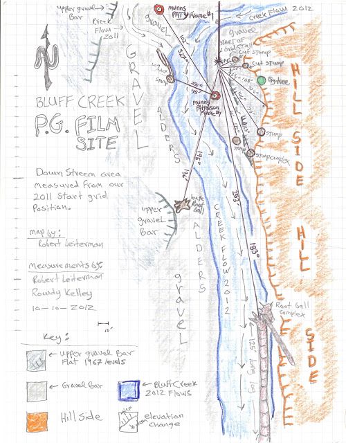
Have you ever discussed the methods you used to make that map?
I'm just curious because, as an archaeologist, I've had a fair amount of training and experience mapping areas (sites), and I know it's not easy to do without a fair amount of experience. I'm not necessarily doubting the accuracy of your map, but I have seen how easy it is to screw up little things and end up with a map that looks very little like what someone else would produce, so I'm curious about how it was made, since you freely admit you and the other people who produced it are amateurs.
Also, can you discuss how you determined the age of the plants you were examined at the site? Some species on the northwest coast grow surprisingly fast, and most people I've known have a hard time accurately guessing the ages of things like trees. For example, I've seen people mistake 40 year old Douglas firs for old growth a number of times because they grow ridiculously fast.
It seems like you lose your patience kind of easily here, but if you expect us to take your point of view as authoritative, some methodology discussion would help.

")
