• Security incident: ISF was recently accessed by intruders. Please change your password, and change it anywhere else you used it. Read more

Merged Mercator projection to be phased out?

Well the reasons to "change the map" were clearly political. What does it even mean btw. I'm I forbidden to print map of the world in Mercator ? Will UN change its logo ? Will web services who use Mercator have to close ?
 
Well the reasons to "change the map" were clearly political. What does it even mean btw. I'm I forbidden to print map of the world in Mercator ? Will UN change its logo ? Will web services who use Mercator have to close ?
The UN logo is a north polar projection. Which also distorts all the land masses.

I think what it means is that official UN organs will not use the Mercator projection in their publications. I assume that most usage is covered by a UN style guide or standards for graphical representations in UN publications.
 
No, I'm mostly hiking mountains, and if I pull out a paper map, it's based on the UTM projection. I'm also trained to use, and make, maps for purposes like nature conservation and city planning. Guess what, we used UTM a lot in our uni GIS projects, because it's incredibly precise, same reason it's used by police, rescue workers, the military, etc. We were trained to put the coordinate system at the bottom of all our maps, so I know the line 'ETRS UTM 1989 sone 32N' by heart. We didn't always use it, of course --my GIS exam project was a map showing the prevalence of domestic violence in Europe, and for that I used a conic projection because it made the most sense in showing Europe.

To be honest I'm not even sure what you mean when you say the original purpose of the Mercator projection isn't there anymore. The main purpose was to be a map projection that allows someone to plot a course and be able to draw it as a straight line on a map. Given people still plot bearings and read them on maps, the projection's original purpose remains.

And again, even with the copout that 'you can just use GPS', chances are said GPS uses the Mercator projection.
Like saying algebra is obsolete and not needed anymore because today people use calculators.

At the risk of saying something relevant to the use of printed maps and navigation...

Some years ago, I was backpacking with my son through a mountain range in eastern Oregon. On our second day, at a rest stop to drink some water, he asked how high I thought we were. I said give me a moment and I'll tell you. I pulled out my printed map and magnetic compass while he was pulling out his cell phone, and the race was on. I was able to tell him our altitude to within 20 feet (the contour interval on my map) before he could get his GPS app to confirm what I had said.
 
Well the reasons to "change the map" were clearly political. What does it even mean btw. I'm I forbidden to print map of the world in Mercator ? Will UN change its logo ? Will web services who use Mercator have to close ?
'The resolution does not ban the Mercator projection or impose a replacement. Instead, it encourages governments, schools, international organizations and technology companies to use the Equal Earth projection and other so-called equal-area maps when relative size matters, and to teach the limitations of any flat map in representing a spherical planet.'

Seems a reasonable enough request to me.
 
The Zulu were expansionist and subjugated neighbouring peoples. Whether you call that 'colonisation' may depend on exact definition you choose
Generally, colonies are regarded as subjugated lands far away from your own lands, whereas subjugating lands adjacent to your own is quite alright, not evil at all.
 
At the risk of saying something relevant to the use of printed maps and navigation...

Some years ago, I was backpacking with my son through a mountain range in eastern Oregon. On our second day, at a rest stop to drink some water, he asked how high I thought we were. I said give me a moment and I'll tell you. I pulled out my printed map and magnetic compass while he was pulling out his cell phone, and the race was on. I was able to tell him our altitude to within 20 feet (the contour interval on my map) before he could get his GPS app to confirm what I had said.
On my local hill, I've had people with handheld GPS units asking me where they were. The GPS was pointing to the location, the problem was what the map actually meant, so I pointed out various landmarks on the map and on the ground and oriented the map. It really was an area with a lot of large topographical features within easy visibility.
 
This thread is in the science subforum, could the discussion stick to map projections and geography? If people want to air their deplorable hottakes on history --and, would it be anthropology?-- the politics subforum is a more suitable place.
I assumed that catsmate put what everyone agrees is a political issue in the science subforum precisely so we can point and laugh at the anti-science nature of the request.

Really, take away the science aspect, and the political aspect takes care of itself: The UN doing UN things.
 
This thread is in the science subforum, could the discussion stick to map projections and geography? If people want to air their deplorable hottakes on history --and, would it be anthropology?-- the politics subforum is a more suitable place.
If someone could make a Politicized Geography subforum we could do both 😊*.

Then again, on a more serious note... Maps are power. Always have been.

*Pretty sure w can do both in this thread anyway, ofc
 
Last edited:
The Zulu were expansionist and subjugated neighbouring peoples. Whether you call that 'colonisation' may depend on exact definition you choose
I just picked them arbitrarily. You are correct, of course. Substitute in a different African or Asian ethnic group to make my argument more accurate.

Well the reasons to "change the map" were clearly political. What does it even mean btw. I'm I forbidden to print map of the world in Mercator ? Will UN change its logo ? Will web services who use Mercator have to close ?
No. What a dumb argument. The UN has changed which projection it uses for its official projects. Nobody is "forbidden" from doing anything.
 
Outrage from people who don't use maps.

People arguing about something that is entirely factual is somewhat amusing.

As to physical maps, people who need them will still use them. I have GPS and charts on my boat.
 
How often do you use the charts instead of the GPS?

Pretty much all the time. Plastic-covered charts don't have a problem with salt water. The relevant chart sits on the dash.

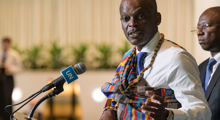
The Togolese, to begin with.

I don't think they were outraged, just asking for a sense of proportion to be taught.

The outrage is from people crying about it.
 
I don't think they were outraged, just asking for a sense of proportion to be taught.
They'd need a sense of proportion first.

The outrage is from people crying about it.
I'm pretty sure it's more of a pointing and laughing situation. Of all the things the nations of sub-Saharan Africa could be asking the UN to help with...

If there is any outrage, it would be over the fact that the replacement map they proposed showed Ukrainian territory as belonging to Russia. That by itself should have been enough to send them scurrying back home, but here we are.
 
Last edited:

ISF - Join now!

Every member here is approved by hand. No bots, no spam, just people who care about evidence and honest debate.

Membership is free!

Create your free account

Back
Top Bottom