• Security incident: ISF was recently accessed by intruders. Please change your password, and change it anywhere else you used it. Read more

Flash flood in Nepal

More than 1000 people dead.
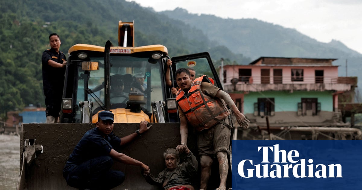
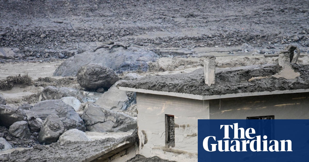
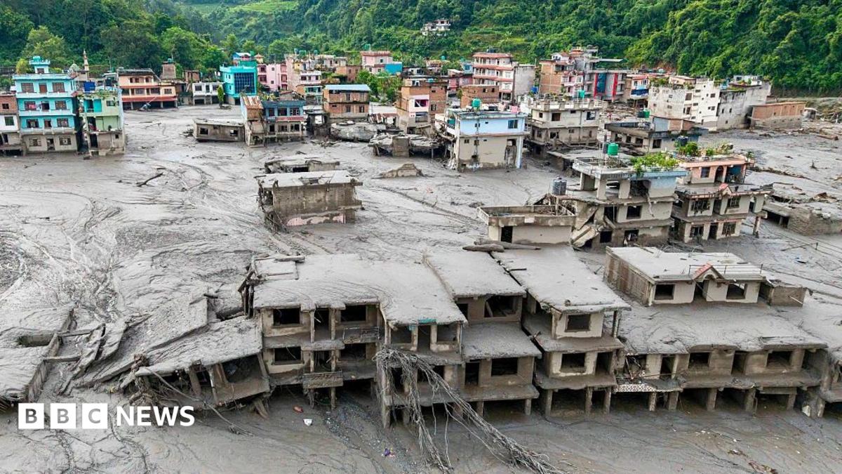
On Wednesday morning local time, a landslide of ice and rock resulted in a torrent of mud, water and debris bursting the banks of the Trishuli river, also known as the Bhotekoshi, which runs between China and Nepal. Homes, roads, bridges and power plants were swept away
I would have thought the flooding would continue until the river met the sea. But they have not said this.
 
Given it seems to have been caused by an earthquake, that's odd.
Terrible business. Lot of Kiwis among the missing/dead, apparently.
Latest reports are that it wasn’t an earthquake but a glacial collapse, down to global warming.

I was there for a month about 6 years ago. Nepalese are just about the most polite and gentle people in the world, despite overwhelming poverty.
 
Given it seems to have been caused by an earthquake, that's odd.

I posted it there when it was breaking news and did comment that it might be the wrong thread when the earthquake explanation was first mooted. It now seems it was the right thread after all.


The US Geological Survey has confirmed that what it had initially reported as an earthquake "was instead a glacial collapse and debris flow" that "caused subsequent catastrophic impacts downstream".

It had first reported the event as a magnitude 4.4 earthquake on Wednesday.

"Additional analysis of nearby seismic stations, long period seismic waves, and satellite imagery led to the determination that the seismic event was instead a glacial collapse and debris flow, and that no earthquake had occurred," the USGS said on Thursday morning.

Earlier Nepali authorities had also told the BBC that a massive chunk of ice may have collapsed from a mountain, pulling down rocks and other sediments with it.

Meanwhile, scientists are still working through the exact sequence of events that could have unleashed such a disaster.
 
That footage from the border crossing looks like when a geologist videos a documentary about some 100 foot high (30m) ancient tsunami, but tells the AI to render a 1000 foot high (60m; metric is logarithmic, right?) tsunami for the cover picture because it looks more dramatic. No I don't doubt it's real, even when I first saw it on a random YouTube clip with no explanation late Tuesday night. But day-um! Roland Emmerich needs to up his game.

It's global warming all right. We broke the glaciers.
 
A few days later, a geologist does a longer analysis, browsing through years of Google Earth imagery in addition to the known photos and video docu of the events themselves.


Here is his gist (summary slides at 23 minutes; following is my paraphrase):
1. (Millions of years): India slams into Asia, folds up Himalayas with all the cracks and ridges and layers of rock, preparing a gazillion of opportunities for rock to fail.
2. (Hundreds ofthousands of years): Glaciers sliding down mount Langtang Lirung (>7,000 meters, among the 100 highest peaks in the world) erode slopes to borderline steep
3. (Tens of thousands of years): Glaciers recede, bedrock gets wetter, loses some support
4. (Decades, years): Rapid warming speeds up the process
5.-7. (Seconds to minutes): A slope of bedrock which happens to have a glacier on top, fails and falls 1,200 meters into a tributary valley, which in turn has a remnant glacier, some of it covered by eroded rock debris - generates 5.2 earthquake, ice melts, water/sediment mix races (~100 mph / 160 km/h) down steep valleys, debris flow destroys border post 7 minutes later.

Willsey points out three things I find interesting and that perhaps change what we / you think we / you know about the event:

A) To him, it is pretty clear that the bedrock failed, with the top glacier falling secondarily - event was NOT triggered by glacier collapse causing berdock to fail secondarily. (He wonders a bit about the sort of rock(s) and how come such a large piece of rock would detach)

B) The valley immediately below the rockfall has obvious moraines and thus once held a sizeable glacier - some unknown length of time ago. However, he shows on Google Earth, bringing up several images throughout the past ~20 years, that there was still a remnant of a galcier in that valley, albeit covered with debris, so not very obvious. That would be one source of water to feed and grease the debris flow

C) There was a second seismic event, a 4.2, consistent with a landslide 3 hours later. That probably happened where, and after, the initial debris flow poured into the next creek valley - the flow (which was heading North then) would have poured up the slope north of the creek, then bounced back South. Possibly, this flow undercut the South slope of the creek's valley, which subsequently collapsed. Later, photos show that a lake had formed upstream from there (which, it would appear, did not cause another catastrophic flash flood)
 
This half-hour video is quite good. I watched it from beginning to end. Hadn't seen this channel before now. However, it seems to be good reporting without too much speculation or opinion.


It does raise the question of whether an effective warning system could have been in place, and the technology for that exists, but unfortunately wasn't in place in the right configuration. This tragedy could be a learning event though, and such a system could be put in place in the future.
 
This half-hour video is quite good. I watched it from beginning to end. Hadn't seen this channel before now. However, it seems to be good reporting without too much speculation or opinion.


It does raise the question of whether an effective warning system could have been in place, and the technology for that exists, but unfortunately wasn't in place in the right configuration. This tragedy could be a learning event though, and such a system could be put in place in the future.

Local neighbours (from Nepal) have advised an element to the tragedy, that I haven't heard elsewhere...

They told me that an emergency evacuation warnings were given from 45 minutes before the collapse, but, because the locals are used to frequent minor flooding, the warnings were ignored.
 
Local neighbours (from Nepal) have advised an element to the tragedy, that I haven't heard elsewhere...

They told me that an emergency evacuation warnings were given from 45 minutes before the collapse, but, because the locals are used to frequent minor flooding, the warnings were ignored.
That was an issue with the 2011 tsunami in Japan, although people should have probably known better given the magnitude of the earthquake. Although many people did heed the warnings and did evacuate to safety, not everyone did, perhaps discounting the risk due to previous warnings for smaller-scale earthquakes/tsunamis that didn't cause significant damage.
 

ISF - Join now!

Every member here is approved by hand. No bots, no spam, just people who care about evidence and honest debate.

Membership is free!

Create your free account

Back
Top Bottom