Yes most likely, but asking for confirmation may reveal stuff.
")
ufology: The reason I asked was in relation to this which you wrote on 24th July:
"The object rose up about two thirds the height of the mountains, stopped, got really bright, and instantly accelerated up the valley north between the mountains, as far as you could see, which is much farther than the above picture has for a field of view ... leaving a glowing trail of light in its wake."
ETA:
Source
Now looking at the relevant details in Google Earth (it's really the first chance I've had to look at this in any sort of detail).
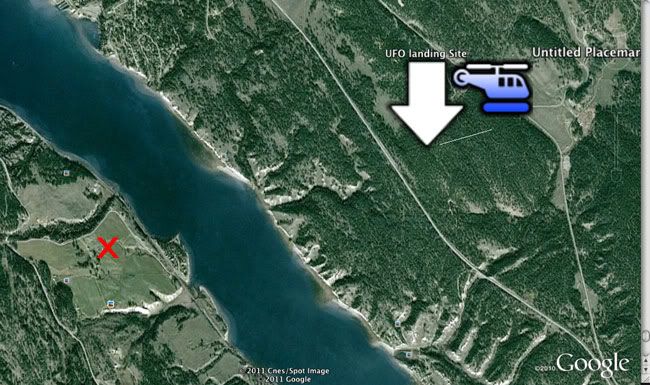
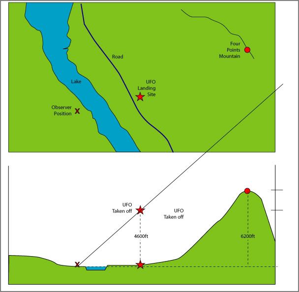
I plotted the positions you've given and that we've estimated (because you bothered for some reason about giving the exact location away) your position at the time of the sighting, which can't really be too far out.
Here is the overhead view:
[qimg]http://i246.photobucket.com/albums/gg117/ThePsychoClown/UFO-Canada.jpg[/qimg]
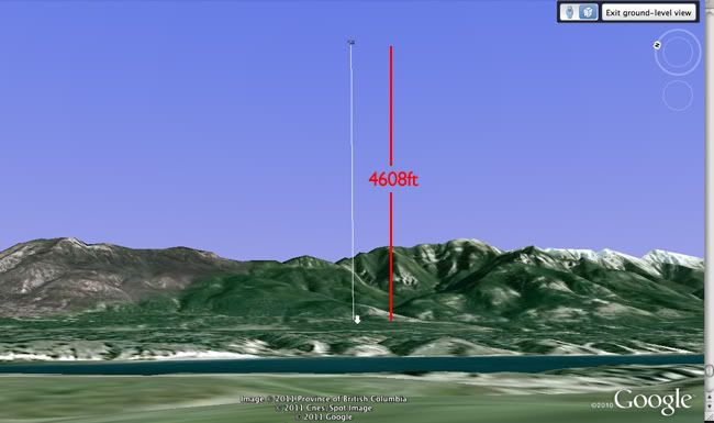
The blue helicopter is actually set to show a 4608ft above ground level, so when we put Google Earth into "Ground Level" view, we see it in relation to the mountains behind.
[qimg]http://i246.photobucket.com/albums/gg117/ThePsychoClown/UFO-Canada-2.jpg[/qimg]
That's not "two thirds the height" of the mountains.
So a lot needs clarifying here. Were you talking relative heights in relation to your viewing position when you mentioned two thirds up the mountain (that would put the object much lower than the later claimed 4608ft) or are you saying you could work out the height of the mountains and mentally triangulate the objects height taking into account it's closer position?
Disclaimer: I realise that Google Earth is not pin point accurate, but it's also not wildly inaccurate so as a rough measure (given the rough information we have work from), it's close enough at this point.


")