Good job with the line of sight. I still don't get how in this photo:
http://2.bp.blogspot.com/_j1WCY4T_2...GXzFTiqGM6s/s1600-h/Coppage+Loyde+England.JPG
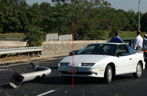
We can see the passenger side front tire just pass the third guardrail column and the back of the cab obscured by the bush, the headlights lined up with the second and third guardrail column, and the cab be where you are placing it behind the trees just north of the bridge.
I'm late to the party, but why do you persist in trying to use such faulty methods of analysis, when it was demonstrated way back on page 1 what you should be doing?
That particular photo is one that Spooked911 (of "Flaming Bunny Cage Experiment" infamy) tried to use on the DU forum last summer as "proof" that the photos had been faked (edit: or the cab was moved), by claiming that this photo couldn't possibly match with the position show in DSC_0420:
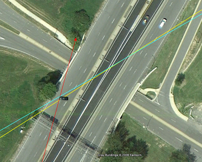
But simply plotting lines-of-sight on an overhead view completely solves the "mystery." As others have pointed out, we can get a reasonably accurate line-of-sight by noting that the cab is just past a line from the center of the tree, passing the right edge of the hanging signs.
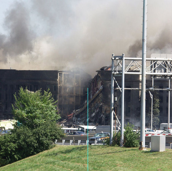
In the photo you're puzzling over, we can get an approximate line-of-sight by noting that a line from the crash site and passing halfway between the trees and the overhead sign structure just touches the right-front corner of the cab:
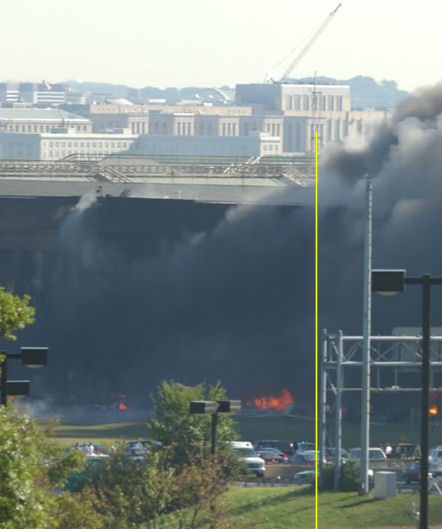
Just for fun, let's throw in another photo that's been discussed, DSC_0412, to see if the three can be reconciled. A very accurate line-of-sight can be drawn from one of the buildings in the distance in downtown Washington, which is the Bureau of Engraving and Printing. (This building has five distinctive wings, each with three tall windows.) A line from the eastern-most wing of the building and passing the left side of the overhead sign structure passes very close to the left-front corner of the cab:
So, putting all three of those lines on the satellite image, I get...
Huh! How about that: I get the same thing everyone else is getting, starting on page 1.
I've never figured out why "no-planers" think that things they don't understand is proof of anything other than the number of things they don't understand, but that's what we keep getting as "proof" over and over. It's way past time (about 20 pages past time) for you to admit your mistakes and take down your faulty analysis. BS never did anyone any good.

")
")