This was mentioned in passing by WildCat much earlier in the thread, but I don't think anyone paid enough attention to it.
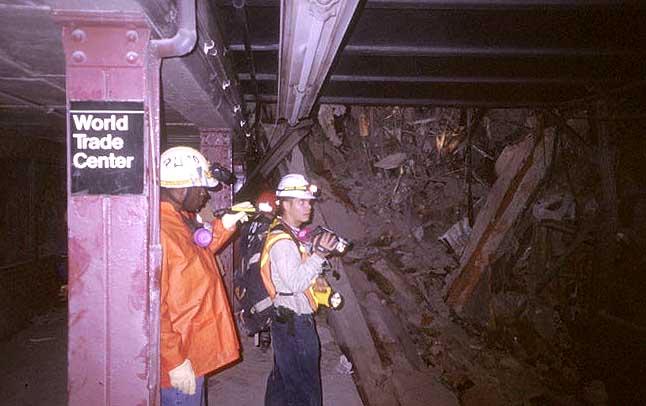
LIDAR mapping was used at Ground Zero after 9/11 to create (and then continuously update) extremely precise and accurate maps of, among other things, the rubble pile heights.
A
National Geographic column explains:
(On might ask, why would officials need this information if the debris were no more than a story high? Any crane can reach a height of one story. Fortunately, there's no need to engage in such speculative, albeit convincing, questioning. The maps themselves exist and can be examined.)
A
CUNY publication explains the project in more detail, including its background in pre-9/11 digital mapping work, and how the new technologies it had developed were put to use in rescue and restoration efforts. I recommend this fascinating article for anyone who hasn't read it yet.
Images generated from some of the maps themselves are now part of the collection of the Library of Congress. Posted here:
http://www.loc.gov/exhibits/911/911-maps.html. Of particular value is the post-September-11th flythrough visualization video (link is about halfway down the page, on the right side). This is based on the same LIDAR data used to plan rescue operations, locate and repair damaged utility links, and plan debris removal. Note that in some areas the rubble is relatively flat, and in others it's piled many stories high.
CARSI's Web site, including current personnel and contact information, and links to other publications and media reports, is here:
http://www.geo.hunter.cuny.edu/~carsi/.
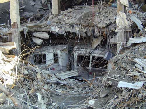
Directly from that site, the height of the rubble piles on 9/19/01:
http://www.geo.hunter.cuny.edu/~carsi/INDEX/CURRENTAFFAIRS/exhibit/lidar_sep.htm. It shows that the top of the rubble piles (NOT counting still-standing structures) relative to the surrounding street level reaches the 75-100 foot elevation range in both tower footprints. Note also the regions of negative elevation, especially in the plaza area where the pre-9/11 elevation was about 30 feet higher than the surrounding street level -- which is certainly not possible without damage to the underground structures in those areas.
More images and renderings here:
http://www.geo.hunter.cuny.edu/~carsi/
This is unambiguous and decisive evidence of large debris piles.
No claims of lack of large debris piles require any rational consideration whatsoever unless they address this evidence.
Respectfully,
Myriad
")
 </blatant attempt at sympathy>